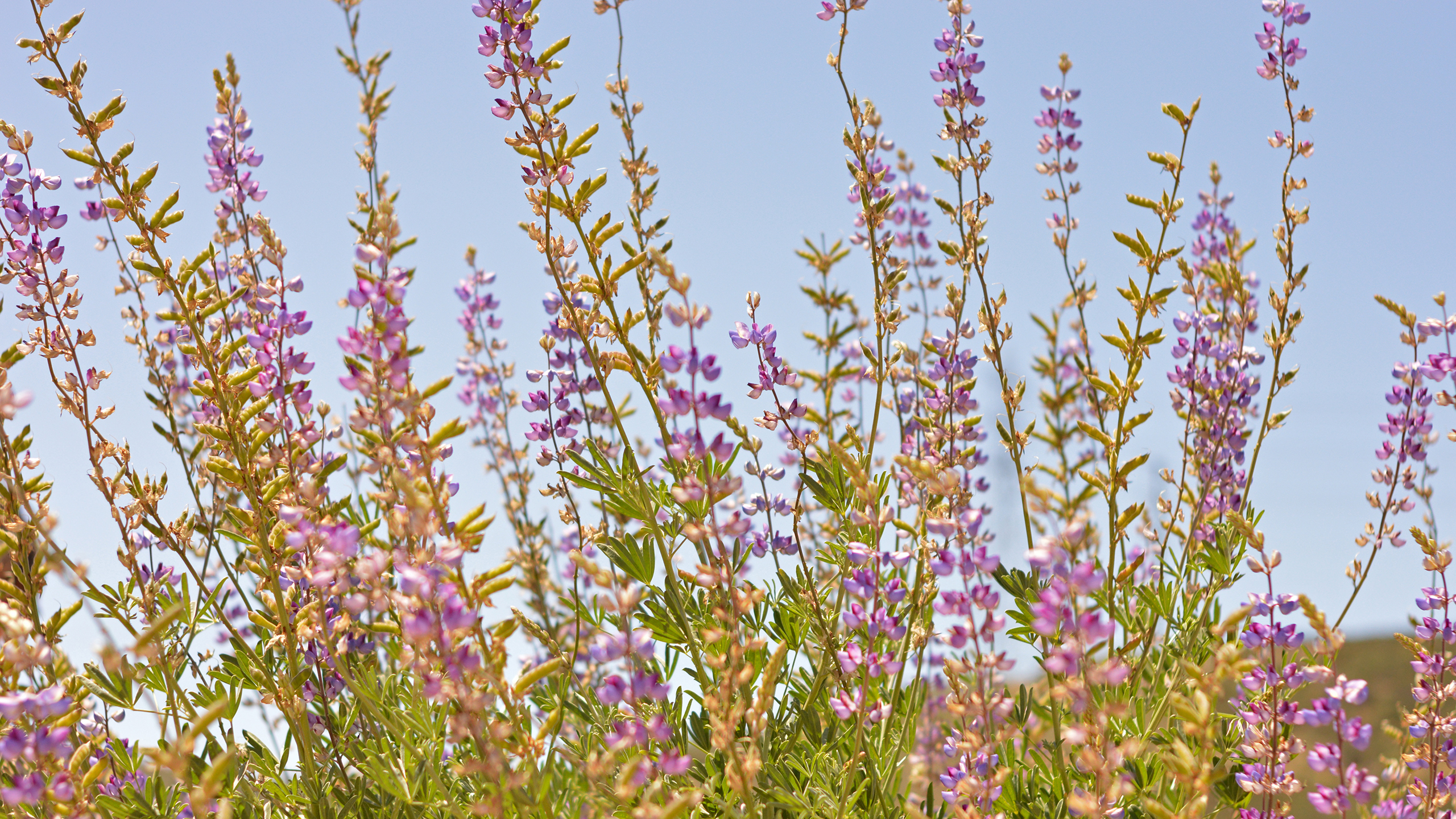
Brachypodium distachyon is an emerging invasive species with potentially widespread
ecological implications for native species, habitats, and ecosystem processes. It has increased in
extent and dominance in recent years in San Diego County, possibly in response to repeated fires
and climatic conditions. Brachypodium decreases native species diversity and may alter soil
ecology, vegetation community structure and composition, and natural fire regimes. This species
is particularly dense on restricted soils and, thus, threatens edaphic endemic plants such as
Acanthomintha ilicifolia, Bloomeria clevelandii, Brodiaea filifolia, Brodiaea orcuttii, Deinandra
conjugens, Dudleya variegata, Nolina interrata, and Tetracoccus dioicus, as well as native
grassland and coastal sage scrub communities. These plants and habitats are conservation targets
under the Natural Community Conservation Planning programs in San Diego County, California.
The conserved areas selected for treatment─Crestridge Ecological Reserve and South
Crest─form a central core area for linking populations of both plants and animals between north
and south San Diego County preserves.
This was a two year, TransNet-funded study on Crestridge Ecological Reserve and South Crest properties. Both properties support MSCP covered species and sensitive habitats, and function as critical landscape linkages between the northern and southern MSCP. Surrounded by residential development and heavily impacted by the 2003 Cedar Fire, these properties are subject to ongoing invasive plant issues. Specific task actions included invasive plant and covered plant species mapping and risk assessment s, invasive plant control and experimental studies, and development of an early detection invasive control plan.
The Crestridge Ecological Reserve is a nearly 2,400-acre Ecological Reserve as designated by the California Fish and Game Commission and a unit of the Multiple Species Conservation Program (MSCP) in San Diego County. The property is subject to a Conservation Bank Agreement with the California Department of Fish and Game (CDFG) and The Nature Conservancy (TNC). Designation as a reserve has protected Crestridge from the threat of development.
The CDFG and MSCP both require the preparation of a habitat management and monitoring plan for the reserve that includes area-specific directives for the land and the species it supports, including species listed as "covered" under the take authorizations of the MSCP. Implementation protocols of the plan are intended to encourage the maintenance or improvement of the habitat quality of the reserve, while remaining adaptable to changing conditions on the reserve. The plan addresses the interface between adjacent developed lands and habitats in the reserve, appropriate land uses within the reserve, and enforcement standards for those uses that are compatible with the short- and long-term maintenance goals of the reserve.
The Back Country Land Trust (BCLT), under a management agreement with CDFG, will work with the CDFG to implement the Habitat Management and Monitoring Plan. In accordance with the plan, BCLT and CDFG will coordinate stewardship efforts for land management, monitoring, and maintenance. BCLT will also develop and implement volunteer and environmental education programs and encourage appropriate use of the land by the general public and the local community.
In 2012, the Conservation Biology Institute (CBI) conducted covered species monitoring and management on the Crestridge Ecological Reserve (CER) and South Crest properties (South Crest) in San Diego County, California. Covered species monitoring focused on detecting and/or assessing the status of four MSCP covered plant species: San Diego thornmint (Acanthomintha ilicifolia), Lakeside ceanothus (Ceanothus cyaneus), variegated dudleya (Dudleya variegata), and Dehesa beargrass (Nolina interrata). Survey and monitoring strategies included presence/absence surveys, and baseline and core monitoring (including photomonitoring). One additional sensitive plant was mapped on South Crest: rush-like bristleweed (Xanthisma junceum ). Covered species management was conducted on both CER and South Crest for San Diego thommint.
Presence/absence surveys were conducted for San Diego thommint, a federally threatened and state endangered species on CER and South Crest. On CER, we revisited the small population found on the slopes above Rios Canyon ('Thommint Hill') in 2010 and 2011, and searched adjacent, suitable habitat for additional stands. San Diego thommint was detected within the 2010/2011 stand boundary; six individuals were detected and five survived to produce flowers. We did not detect thornmint elsewhere onsite. Much of the formerly suitable habitat is now dominated by the nonnative grass, purple falsebrome (Brachypodium distachyon ). Monitoring within this small stand included both baseline and core monitoring to document the population boundaries and current status, including threats. Recommendations include continued monitoring and weed control efforts, and possibly, population augmentation via seed.
On South Crest, surveys assessed all historic locations and potentially suitable habitat in and around Skeleton Flats. Although San Diego thornmint was not detected in historic locations, two new occurrences were detected in the low-lying hills just east of Skeleton Flats. The larger occurrence consists of approximately 950 plants and the smaller occurrence supports about 185 plants. Baseline monitoring and elements of core monitoring were conducted for these populations. Recommendations include continued monitoring and weed control efforts.
Lakeside ceanothus occurs only on CER. In 2012, we continued the photomonitoring program initiated in 2010. Monitoring was conducted at seven locations and compared to 2010 and 2011 results. In three locations, nonnative pl
The Crestridge Ecological Reserve is an approximately 2,638-acre Ecological Reserve as designated by the California Fish and Game Commission and a unit of the Multiple Species Conservation Program (MSCP) in San Diego County. The property is subject to a Conservation Bank Agreement with the California Department of Fish and Game (CDFG). Designation as an ecological reserve has protected Crestridge from the threat of development.
The goals of the MSCP are consistent with the goals of an Ecological Reserve. The MSCP provides special protection for the irreplaceable resources in San Diego County and guides development outside of biological resource core areas. Protection of these irreplaceable resources is vital to the general welfare of all residents. Central to the MSCP is the maintenance of ecosystems and vegetation communities that support sensitive species and fragile, regionally declining resources. The MSCP's goal is to prevent future endangerment of the plants and animals that are dependent on these habitats.
A draft of this plan was initially developed in February 2002 for an approximately 2,377-acre reserve area. Since that time, there have been major changes on the reserve:
Approximately 261 acres formerly conserved as mitigation by the San Diego County Water Authority have been added to the western end of the reserve.
Approximately 1,900 acres of the reserve burned in the 2003 Cedar fire, and EHC and the California Department of Forestry and Fire Protection (CalFire) have reevaluated fire management strategies for the reserve.
A cultural resource management plan was prepared for a portion of the reserve and is included in this updated plan.
Several biological management and monitoring projects have been initiated; these are summarized in Section 8.1 of this plan.
The Earth Discovery Institute has been established, and educational programs have been implemented through a series of grants. Endangered Habitats Conservancy 1-2 February 2009
An interpretive kiosk has been built at the entrance of the reserve, as a symbol of the legacy and significance of the land to the surrounding residential community.
Thus, this draft plan is to incorporate these changes and update the management and monitoring needs for the reserve. This management and monitoring plan is intended to cover current and future land additions to the reserve, with specific management and monitoring needs to be developed in accordance with this plan as lands are added.
In 2012, the Conservation Biology Institute (CBI) conducted covered species monitoring
and management on the Crestridge Ecological Reserve (CER) and South Crest properties
(South Crest) in San Diego County, California. Covered species monitoring focused on
detecting and/or assessing the status of four MSCP covered plant species: San Diego
thornmint (Acanthomintha ilicifolia), Lakeside ceanothus (Ceanothus cyaneus),
variegated dudleya (Dudleya variegata), and Dehesa beargrass (Nolina interrata).
Survey and monitoring strategies included presence/absence surveys, and baseline and
core monitoring (including photomonitoring). One additional sensitive plant was mapped
on South Crest: rush-like bristleweed (Xanthisma junceum). Covered species
management was conducted on both CER and South Crest for San Diego thommint.
The CDFG and MSCP both require the preparation of a habitat management and monitoring plan for the reserve that includes area-specific directives for the land and the species it supports, including species listed as covered under the take authorizations of the MSCP. Implementation protocols of the plan are intended to encourage the maintenance or improvement of the habitat quality of the reserve, while remaining adaptable to changing conditions on the reserve. The plan addresses the interface between adjacent developed lands and habitats in the reserve, appropriate land uses within the reserve, and enforcement standards for those uses that are compatible with the short- and long-term maintenance goals of the reserve.
A draft of this plan was initially developed in February 2002 for an approximately 2,377-acre reserve area. Since that time, there have been major changes on the reserve. Thus, this draft plan is to incorporate these changes and update the management and monitoring needs for the reserve. This management and monitoring plan is intended to cover current and future land additions to the reserve, with specific management and monitoring needs to be developed in accordance with this plan as lands are added.
In FY 2011, the California Department of Fish and Game (DFG) funded this initial study by a Natural Community Conservation Plan (NCCP) Local Assistance Grant (LAG) to determine if badgers still persist in the western portion of San Diego County. Survey sites were prioritized according to three criteria; 1) areas with historical and/or recent badger records, 2) conserved lands with priority given to MSCP and Multiple Habitat Conservation Plan (MHCP) lands, and 3) areas containing moderate to abundant grassland habitat.
We conducted canine scent surveys for American badger scat using a specially trained canine scent team from Conservation Canines (Heath Smith and Pips; University of Washington) from November 14 to December 14, 2011. We surveyed for badger scat across 32 sites within San Diego County and two sites in southern Riverside County. Pips had positive behavioral responses to scat at 13 sites. Using a badger specific DNA test, we were able to verify the scat collected to be that of the American badger at twelve sites: Marine Corps Base Camp Pendleton (Juliett and Oscar One), Fallbrook Naval Weapons Station, Daley Ranch in Escondido, Ramona Grasslands, Warner Springs Ranch, Whelan Lake, Crestridge Ecological Reserve, Santa Ysabel Ecological Reserve, Hollenbeck Canyon Wildlife Area, Marron Valley, and the Santa Rosa Plateau.
Because badgers are present within the western portion of the County, they are a suitable species for assessing upland connectivity by means of radio-telemetry. As a priority for research, we recommend follow-up focused surveys to identify target areas for future live-trapping and telemetry and to better define any areas with higher densities of badgers. We recommend development of a microsat
Brachypodium distachyon is an emerging invasive species with potentially widespread ecological implications for native species, habitats, and ecosystem processes. It has increased in extent and dominance in recent years in San Diego County, possibly in response to repeated fires and climatic conditions. Brachypodium decreases native species diversity and may alter soil ecology, vegetation community structure and composition, and natural fire regimes. This species is particularly dense on restricted soils and, thus, threatens edaphic endemic plants such as Acanthomintha ilicifolia, Bloomeria clevelandii, Brodiaea filifolia, Brodiaea orcuttii, Deinandra conjugens, Dudleya variegata, Nolina interrata, and Tetracoccus dioicus, as well as native grassland and coastal sage scrub communities. These plants and habitats are conservation targets under the Natural Community Conservation Planning programs in San Diego County, California. The conserved areas selected for treatment─Crestridge Ecological Reserve and South Crest─form a central core area for linking populations of both plants and animals between north and south San Diego County preserves.
Environmental Mitigation Program Grant No. 5001965
EXECUTIVE SUMMARY: This report combines the results of two tasks funded under a local assistance grant from the California Department of Fish and Game (CDFG) for Multiple Species Conservation Program (MSCP) wildlife corridor monitoring: (1) the second consecutive year of monitoring for locations in the cities of Poway and San Diego, surveyed by San Diego State University (SDSU) graduate students (contract Task D) and (2) the first year of monitoring for new transect locations established by the Conservation Biology Institute (CBI) and San Diego Tracking Team (SDTT) (contract Task A). CBI directed both studies. Transects at some of the Poway-San Diego monitoring stations established in 2000 (CBI 2002b) were not re-surveyed, while monitoring protocols were altered slightly based on recommendations from CBI (2002b). Specifically, in addition to the data collected at baited track stations, the presence or absence of wildlife, as evidenced by all types of sign, was recorded along the entire length of the transect to compare the methods. These sign surveys along the track station transects are thus similar to surveys conducted by the SDTT. The SDTT monitored wildlife use at new locations at Lusardi Creek, culverts under SR-67, Crestridge Ecological Reserve, Hollenbeck Canyon, Otay Mesa Road culvert, and Spring Canyon, in addition to continued monitoring at stations previously established by the SDTT, including the Scripps-Poway Parkway underpass and Sycamore Park Drive. As part of this grant, SDTT also entered data for all 48 SDTT transects, collected from 1996 to present. CBI and SDTT hope to conduct analyses of these data as part of a future project. Based on results of 2 years of monitoring, this report makes recommendations for: Habitat management needs at monitoring locations; Survey methods (standardized 1-km sign transects, with cameras at chokepoints); Collection and mapping of roadkill data in the vicinity of monitoring locations; Centralized data analysis and data management. In a separate report, CBI (2003) recommended locations for MSCP habitat linkage monitoring, which include the locations presented in this report.
The Brachypodium Phase II project treated 19.5 acres of Brachypodium-infested habitat, and compared monitoring methods and treatment effectiveness on the Crestridge Ecological Reserve and South Crest Preserve in San Diego County, California. This project continued treatments initiated under the Brachypodium Phase I project. The San Diego Association of Government (SANDAG) Transnet Environmental Mitigation Program provided grant funding for both projects. Phase II objectives included (1) monitoring treatment areas, (2) assessing monitoring methods, (3) reducing nonnative species cover through herbicide application, and (4) refining Best Management Practices (BMPs) for Brachypodium control. We monitored treatment areas (native species richness, cover) quantitatively in 2016 and semi-quantitatively in 2016 and 2017, and continued herbicide treatment of Brachypodium and nonnative grasses and forbs in all Phase I treatment areas.
Brachypodium distachyon is an emerging invasive species with potentially widespread
ecological implications for native species, habitats, and ecosystem processes. It has increased in extent and dominance in recent years in San Diego County, possibly in response to repeated fires and climatic conditions. Brachypodium decreases native species diversity and may alter soil ecology, vegetation community structure and composition, and natural fire regimes. This species is particularly dense on restricted soils and, thus, threatens edaphic endemic plants such as Acanthomintha ilicifolia, Bloomeria clevelandii, Brodiaea filifolia, Brodiaea orcuttii, Deinandra conjugens, Dudleya variegata, Nolina interrata, and Tetracoccus dioicus, as well as native
grassland and coastal sage scrub communities. These plants and habitats are conservation targets under the Natural Community Conservation Planning programs in San Diego County, California. The conserved areas selected for treatment─Crestridge Ecological Reserve and South Crest─form a central core area for linking populations of both plants and animals between north and south San Diego County preserves.